


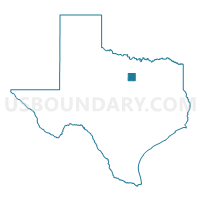
Parker County PUMA, Texas
About
Outline

Summary
| Unique Area Identifier | 194208 |
| Name | Parker County PUMA |
| State | Texas |
| Area (square miles) | 910.09 |
| Land Area (square miles) | 903.48 |
| Water Area (square miles) | 6.62 |
| % of Land Area | 99.27 |
| % of Water Area | 0.73 |
| Latitude of the Internal Point | 32.77709640 |
| Longtitude of the Internal Point | -97.80590490 |
Maps

Graphs
Select a template below for downloading or customizing gragh for Parker County PUMA, Texas


Neighbors
Neighoring Public Use Microdata Area (by Name) Neighboring Public Use Microdata Area on the Map
- Johnson County PUMA, TX
- North Central Texas COG (West)--Hood, Erath, Palo Pinto & Somervell Counties PUMA, TX
- North Texas Regional Planning Commission (Outside Wichita County) & Wise County PUMA, TX
- Tarrant County (Northwest)--Fort Worth (Northwest) & Saginaw Cities PUMA, TX
- Tarrant County (Southwest)--Fort Worth (Southwest) & Benbrook Cities PUMA, TX
- Tarrant County (West)--Fort Worth City (West) PUMA, TX
Top 10 Neighboring County (by Population) Neighboring County on the Map
- Tarrant County, TX (1,809,034)
- Johnson County, TX (150,934)
- Parker County, TX (116,927)
- Wise County, TX (59,127)
- Hood County, TX (51,182)
- Palo Pinto County, TX (28,111)
- Jack County, TX (9,044)
Top 10 Neighboring County Subdivision (by Population) Neighboring County Subdivision on the Map
- Fort Worth CCD, Tarrant County, TX (791,745)
- Granbury East CCD, Hood County, TX (41,920)
- Springtown-Reno CCD, Parker County, TX (37,832)
- Weatherford CCD, Parker County, TX (37,677)
- Weatherford Southeast CCD, Parker County, TX (27,636)
- Bridgeport CCD, Wise County, TX (21,446)
- Mineral Wells CCD, Palo Pinto County, TX (19,544)
- Boyd-Rhome CCD, Wise County, TX (18,608)
- Weatherford Northwest CCD, Parker County, TX (13,782)
- Granbury West CCD, Hood County, TX (9,262)
Top 10 Neighboring Place (by Population) Neighboring Place on the Map
- Fort Worth city, TX (741,206)
- Weatherford city, TX (25,250)
- Mineral Wells city, TX (16,788)
- Azle city, TX (10,947)
- Briar CDP, TX (5,665)
- Willow Park city, TX (3,982)
- Aledo city, TX (2,716)
- Springtown city, TX (2,658)
- Reno city, TX (2,494)
- Hudson Oaks city, TX (1,662)
Top 10 Neighboring Unified School District (by Population) Neighboring Unified School District on the Map
- Fort Worth Independent School District, TX (466,910)
- Granbury Independent School District, TX (47,990)
- Weatherford Independent School District, TX (47,338)
- Azle Independent School District, TX (36,509)
- White Settlement Independent School District, TX (31,573)
- Aledo Independent School District, TX (20,504)
- Mineral Wells Independent School District, TX (19,494)
- Springtown Independent School District, TX (18,468)
- Godley Independent School District, TX (7,057)
- Peaster Independent School District, TX (4,449)
Top 10 Neighboring State Legislative District Lower Chamber (by Population) Neighboring State Legislative District Lower Chamber on the Map
- State House District 99, TX (231,238)
- State House District 61, TX (176,054)
- State House District 58, TX (169,146)
- State House District 97, TX (168,045)
- State House District 60, TX (148,990)
- State House District 68, TX (135,942)
Top 10 Neighboring State Legislative District Upper Chamber (by Population) Neighboring State Legislative District Upper Chamber on the Map
- State Senate District 12, TX (1,013,641)
- State Senate District 10, TX (834,265)
- State Senate District 30, TX (823,594)
- State Senate District 22, TX (789,412)
Top 10 Neighboring 111th Congressional District (by Population) Neighboring 111th Congressional District on the Map
- Congressional District 12, TX (831,100)
- Congressional District 6, TX (809,095)
- Congressional District 17, TX (760,042)
- Congressional District 13, TX (672,781)
Top 10 Neighboring Census Tract (by Population) Neighboring Census Tract on the Map
- Census Tract 1404.07, Parker County, TX (10,214)
- Census Tract 1406.02, Parker County, TX (9,585)
- Census Tract 1506.01, Wise County, TX (7,962)
- Census Tract 1407.04, Parker County, TX (7,495)
- Census Tract 1405.01, Parker County, TX (7,307)
- Census Tract 1602.09, Hood County, TX (7,206)
- Census Tract 1406.01, Parker County, TX (7,178)
- Census Tract 1407.05, Parker County, TX (7,148)
- Census Tract 1407.06, Parker County, TX (6,557)
- Census Tract 1405.02, Parker County, TX (6,475)
Top 10 Neighboring 5-Digit ZIP Code Tabulation Area (by Population) Neighboring 5-Digit ZIP Code Tabulation Area on the Map
- 76108, TX (38,227)
- 76020, TX (27,270)
- 76049, TX (25,130)
- 76087, TX (24,746)
- 76067, TX (22,117)
- 76048, TX (21,989)
- 76086, TX (20,196)
- 76126, TX (19,395)
- 76082, TX (17,748)
- 76008, TX (13,602)